- 26 November 2025
- Posted by: EYATH S.A.
- Category: All News
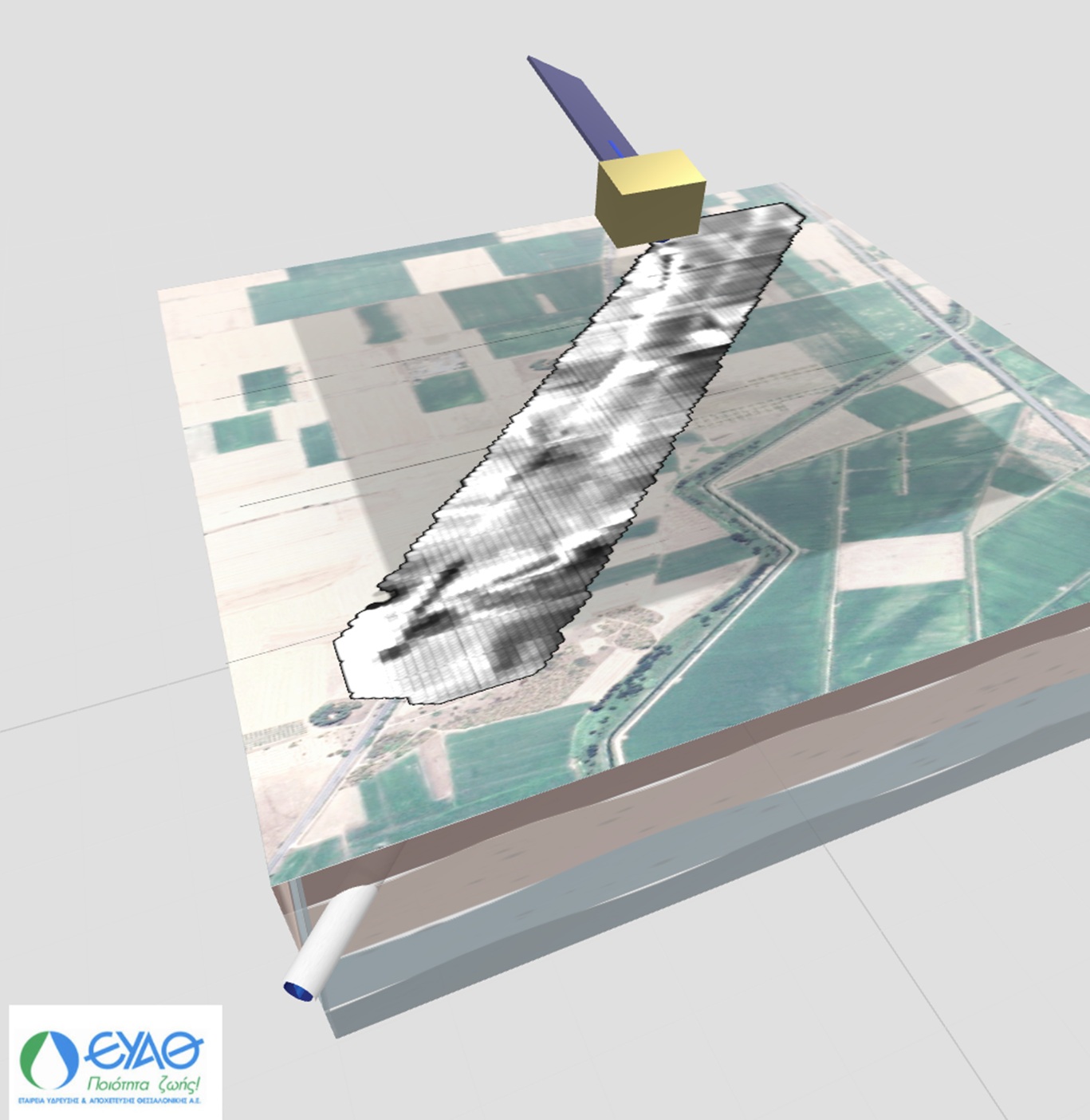
Visual representation of the methodology: the synthetic map of the surface traces (top, gray shade) is projected onto the real geospatial background, revealing the linear surface “signature” of the Aravissos underground aqueduct.
EYATH won its first patent, with a patent concerning an innovative method of satellite analysis designed to accurately locate underground pipelines, creating conditions for the detection of potential leaks. This technological achievement opens new avenues in the monitoring and protection of water infrastructure and water resources, recognizing elements that were not visible until now with conventional means.
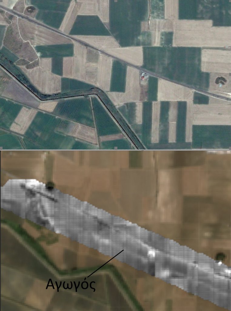
The patent, which studies and is based on changes in the color of the soil over time, has the ability to reveal the subtle but persistent “signatures”, i.e. the traces that underground pipes leave on the surface of the soil, information that is particularly useful for the detection of leaks. In fact, it allows the identification of elements that were not visible with conventional means and has already been successfully tested in the underground aqueduct of Aravissos, the second main aquifer of Thessaloniki. In particular, the methodology developed helped to identify sections of the aqueduct whose precise layout was not fully known, while also allowing the study of the seasonal interaction between the underground pipeline and the surface zone of the soil, creating conditions for the development of an integrated system of recording and notifying on time when in crisis conditions for the pipeline (these could include prolonged zones of soil change not associated with the seasonality, possibly indicating an unusual concentration of surface moisture along the pipeline route).
The patent works reliably in natural environments, rural and non-urbanized areas, while its technological background paves the way for potential applications related to the detection of other types of underground pipelines, such as district heating pipelines, sewage pipelines or even fuel pipelines. At the same time, its use could be extended to other applications for locating underground structures, e.g. for geotechnical investigations or even to identify areas of possible archaeological interest.
“This is the result of the systematic research and technological maturation that we have been developing in recent years within the Research & Development Department of EYATH. The company constantly invests in the study and exploitation of modern technologies and the patenting of the methodology by the OBI is one of the important results of this course”, points out Yannis Lioubas, pioneer of the project at the Research & Development Department of EYATH.
“Winning our first patent is a milestone for EYATH, another practical proof that innovation is embedded in our DNA. The patent developed by our company’s R&D team, of which we are proud, breaks new ground in the detection of underground pipes and potential leaks. This particular distinction is not just a scientific success, it is another proof that EYATH is looking steadily towards the future, investing in technologies that enhance the safety, efficiency and sustainability of our water resources”, points out EYATH CEO, Anthimos Amanatidis.
“The granting of the patent proves in practice that EYATH is actively participating in the formation of the European innovation ecosystem in water technologies and highlights its leading role in the field. The original satellite analysis method for locating underground pipelines is a technology of high added value, confirming the company’s ability to produce solutions that upgrade the monitoring of critical infrastructures, with fields of application that go beyond the limits of Thessaloniki”, points out the director of the Directorate of Strategic Planning, Projects & Development of EYATH, Alexandros Mendes.
This patent is a new development tool for the company and its expansion in international level is already being considered. In addition to its operational use within EYATH, the methodology can form the basis for a new field in the study of underground infrastructures, while creating prospects for research collaborations and the transfer of know-how to new areas of application.
Application of the methodology to the underground aqueduct of Aravissos: in the upper image, the satellite image, in the lower one, the synthetic map that captures the persistent color changes of the soil along the route of the pipeline, which are related to its presence.